
As Amazon Associates, we earn from qualifying purchases. This means we may receive a small commission at no extra cost to you if you click through and make a purchase.
As an Amazon Associate we earn from qualifying purchases. Links on this page are affiliate links.
Understanding C-MAP Mapping for Fish Finders
Mapping is a critical feature for anglers who want to navigate unknown waters with confidence. It provides detailed digital charts of the ocean or lake bottom directly on your fish finder screen. This technology helps you locate structure, depth changes, and potential fish habitats without needing separate paper charts.
The specific mapping data in this guide comes from C-MAP. C-MAP is a well-known provider of high-resolution nautical charts. These charts are created using advanced surveying techniques. The data includes precise depth measurements, underwater terrain, and navigational hazards. When you see C-MAP listed in the specifications, it means the device can display these detailed underwater landscapes.
How does it work? Your fish finder receives satellite signals or uses sonar to gather real-time depth data. This information is overlaid onto the pre-loaded C-MAP charts. The result is a clear visual representation of what lies beneath your boat. You can see contours, drop-offs, and sandy or rocky bottoms in real time. This allows for precise navigation and better fishing strategies.
When shopping, look for C-MAP in the product specs. It may appear as C-MAP LiveLock, C-MAP Genesis, or standard C-MAP charts. The level of detail varies. High-resolution charts show fine structures. Standard charts provide broader overview data. Ensure the mapping data covers your local fishing areas. Some devices require separate memory cards or subscriptions for the latest updates.
Why does this matter to you? Accurate mapping saves time and improves safety. You can avoid shallow areas and navigate to productive spots faster. It also helps in planning your fishing trips. Knowing the underwater terrain beforehand allows you to choose the right lures and techniques. With C-MAP data, you gain a significant advantage in understanding your fishing environment. This spec is essential for serious anglers who value precision and reliability in their gear.
C-MAP Mapping Features
C-MAP
C-MAP delivers preloaded digital charts for US inland waters. You receive detailed bathymetric data showing bottom structure and depth contours. This helps you locate fish habitats without guessing. The Lowrance Eagle 7 TripleShot HD uses this mapping for compact boats. It balances screen size with chart detail. You benefit from clear underwater topography on your display. However, C-MAP focuses on specific regions. It may lack global coverage found in other systems. If you fish US lakes, this is a strong choice. You get reliable charts right out of the box. No extra setup is needed for basic navigation. The data is static but highly detailed for local waters. This suits anglers who prioritize known fishing spots over open ocean exploration. The trade-off is limited geographic scope outside the mapped areas.
C-MAP Contour+
C-MAP Contour+ offers enhanced chart detail for specific lakes. You get higher resolution data for shallow water navigation. The Lowrance Elite FS 9 includes this for detailed underwater mapping. It is ideal for those who value preloaded charts. You benefit from precise depth information in known waters. This feature suits anglers targeting specific lake structures. The trade-off is that coverage is not universal. You must ensure your fishing area is included in the dataset. This system is less flexible for new or remote locations. It works best when you stick to mapped regions. You get excellent detail where available. However, you cannot easily add new charts without purchase. This limits spontaneity if you explore uncharted waters. It is a solid choice for dedicated local anglers.
Is C-MAP Worth Your Money?
Who needs it
You should prioritize this spec if you frequently fish in US inland waters. The preloaded digital charts provide detailed bathymetric data right on your screen. This means you see bottom structure and depth contours without needing to guess. For anglers on compact boats, this integration is vital. It allows you to locate fish habitats with precision. You save time by navigating unknown waters confidently. The mapping helps you identify key structural changes that hold fish. If you rely on finding specific spots quickly, this feature is essential. It turns your fish finder into a powerful navigation tool. You get a clear picture of the underwater terrain. This helps you plan your route and target areas effectively. It is a practical asset for serious anglers who value efficiency and accuracy in their fishing trips.
Who can skip it
You can skip this if you only fish in small, familiar ponds. The detailed charts may be overkill for such simple environments. You might prefer a basic depth sounder instead. This keeps the unit simpler and easier to use. If you do not care about bottom structure, skip it. Focus on core sonar performance instead. Look for clear water column views. Prioritize fast target acquisition and high resolution. These features help you see fish directly. They are more useful for casual anglers. You do not need complex navigation tools for casual use. Stick to essential functions. This saves you from unnecessary complexity. It keeps your device lightweight and straightforward. Simple is better for relaxed fishing days. You avoid clutter on the screen. This lets you focus on the basics. It is a practical choice for those who want simplicity over detailed mapping.
Mapping Glossary Terms
Bathymetry
The measurement of water depth and the shape of the bottom. Fish finders use this data to show you contours and underwater terrain.
Contour Lines
Lines on a map that connect points of equal depth. They help you visualize slopes, drop-offs, and flat areas where fish may hide.
Chart Plotter
A device that combines GPS navigation with digital maps. It allows you to see your position relative to the mapped bottom structure.
Digital Chart
A computer-readable map of water bodies. These charts provide detailed information about depth, hazards, and points of interest for navigation.
Bottom Structure
Physical features on the lake or ocean floor. Examples include rocks, weeds, and ledges that attract fish and affect their movement patterns.
Preloaded Maps
Digital charts included with the device out of the box. You do not need to purchase or download them separately to use basic features.
Waypoint
A specific geographic location saved in the device. You can mark spots like good fishing holes or navigational markers for future trips.
| # | Product | Best for | Price |
|---|---|---|---|
| 1 | Lowrance Eagle 7 TripleShot HD Fish Finder | Compact boats needing detailed sonar and US mapping | |
| 2 | Lowrance Elite FS 9 Fish Finder | Anglers needing large display and Active Imaging 3-in-1 | |
| 3 | Simrad GO9 XSE 9-Inch Fish Finder | Sportboat owners needing detailed US/Canada mapping | |
| 4 | Lowrance Elite FS 7 Touchscreen | Compact boats needing detailed C-MAP charts | |
| 5 | Lowrance Eagle Eye 9 Live Sonar Fish Finder | US inland lake mapping with live sonar | |
| 6 | Lowrance HOOK Reveal 5 SplitShot Fish Finder | US inland fishing with clear 5-inch visibility |

Lowrance Eagle 7 TripleShot HD Fish Finder
Best for: Compact boats needing detailed sonar and US mapping
- Mapping
- C-MAP
- Display Size
- 7-inch
- Sonar Technology
- CHIRP, SideScan, DownScan, FishReveal
- Display Type
- IPS
- Dimensions
- 8.89 × 3.48 × 5.5 inches
- Weight
- 1.5 pounds
The Lowrance Eagle 7 TripleShot HD is a 7-inch fish finder with an IPS display. It uses SideScan, DownScan, and CHIRP sonar to locate fish and structure. The unit includes C-MAP US Inland charts covering over 17,000 lakes and supports Genesis Live mapping. This balanced size offers detailed sonar and chart data without the bulk of a 9-inch unit, making it suitable for anglers who want comprehensive mapping and sonar in a compact form.
- 7-inch IPS display provides clear viewing
- TripleShot HD combines SideScan, DownScan, and CHIRP sonar
- C-MAP US Inland charts cover 17,000+ lakes
- Supports Genesis Live mapping for custom routes
- Smaller 7-inch screen compared to 9-inch competitors
- Heavier at 1.5 pounds compared to lighter units
- Limited to US Inland charts without extra purchase
- You want a compact 7-inch display for smaller boats
- You need detailed sonar and mapping in one unit
- You fish in US inland waters with C-MAP charts
- You prefer a larger 9-inch screen for better visibility
- You need global or international chart coverage
- You want a lighter unit under 1.5 pounds
Verdict: Lowrance Eagle 7 TripleShot HD fits anglers who need a compact 7-inch unit with detailed sonar and US inland mapping. It offers a balanced screen size for smaller boats while providing comprehensive fish-finding capabilities.
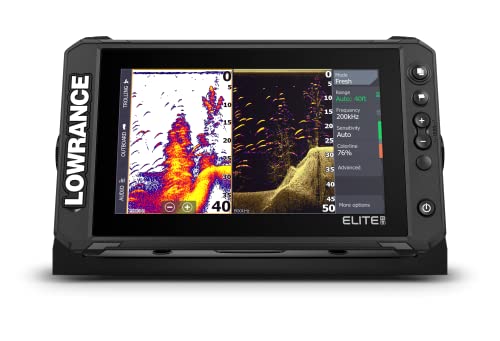
Lowrance Elite FS 9 Fish Finder
Best for: Anglers needing large display and Active Imaging 3-in-1
- Mapping
- C-MAP
- Display Size
- 9 Inch
- Sonar Technology
- Active Imaging 3-in-1
- Dimensions
- 16 × 14.1 × 5.54 inches
This Lowrance Elite FS 9 fish finder features a 9-inch display and Active Imaging 3-in-1 sonar technology. It comes preloaded with C-MAP Contour+ charts for detailed mapping. The unit measures 16 inches in length and 14.1 inches in width. You get a large screen for clear visibility of underwater structures and fish. The included transducer provides comprehensive sonar coverage for various fishing conditions.
- 9-inch display size for better visibility
- Active Imaging 3-in-1 sonar technology
- Preloaded C-MAP Contour+ charts
- Includes Active Imaging 3-in-1 transducer
- 16-inch length is bulkier than smaller units
- 14.1-inch width requires more mounting space
- 9-inch screen is larger than 5-inch options
- You want a large 9-inch display for clear viewing
- You need Active Imaging 3-in-1 sonar for detailed sonar images
- You prefer preloaded C-MAP Contour+ charts for mapping
- You need a compact unit under 7 inches
- You prefer smaller dimensions for limited mounting space
- You do not need Active Imaging 3-in-1 sonar
Verdict: Lowrance Elite FS 9 9-inch Fish Finder suits anglers who prioritize a large 9-inch display and Active Imaging 3-in-1 sonar for detailed underwater mapping. It is ideal for those who value preloaded C-MAP Contour+ charts and do not mind a bulkier 16-inch form factor.

Simrad GO9 XSE 9-Inch Fish Finder
Best for: Sportboat owners needing detailed US/Canada mapping
- Mapping
- C-MAP
- Display Size
- 9-inch
- Sonar Technology
- CHIRP, DownScan Imaging
- Features
- GPS
- Dimensions
- 11.3 × 3.5 × 6.55 inches
The Simrad GO9 XSE is a 9-inch chartplotter featuring C-MAP DISCOVER mapping. It includes a HDI transducer with Medium/High CHIRP and DownScan Imaging for clear underwater views. The device offers radar-ready connectivity and built-in smartphone mirroring. It suits sportboat and center-console owners who need detailed bathymetric contours and tidal data for US and Canadian waters.
- 9-inch display size for clear viewing
- C-MAP DISCOVER card with vector charts
- HDI transducer with DownScan Imaging
- Radar-ready plug-and-play connectivity
- Built-in NMEA 2000 integration
- Smaller 9-inch screen compared to 7-inch and 9-inch options in this list
- Requires separate radar purchase for full functionality
- Limited to US and Canada chart coverage
- You want detailed bathymetric contours and tidal data
- You own a sportboat or center-console
- You plan to add radar later
- You need international chart coverage beyond North America
- You prefer a larger display than 9 inches
- You want radar included in the base package
Verdict: Simrad GO9 XSE 9-inch Chartplotter fits captains who prioritize high-resolution sonar and detailed mapping for North American waters. It is a solid choice for sportboat owners ready to expand their radar setup.
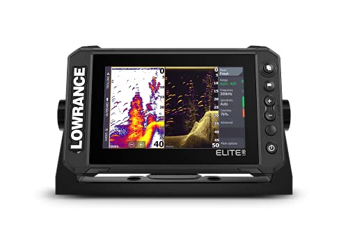
Lowrance Elite FS 7 Touchscreen
Best for: Compact boats needing detailed C-MAP charts
- Mapping
- C-MAP
- Display Size
- 7 Inch
- Sonar Technology
- Active Imaging, ActiveTarget 2
- Display Type
- Touchscreen
- Dimensions
- 16 × 11.4 × 5.42 inches
- Weight
- 1.9 pounds
The Lowrance Elite FS 7 is a 7-inch touchscreen fish finder designed for compact installations. It comes with preloaded C-MAP Contour+ and Discover charts to help you locate fish-holding areas. The unit supports Active Imaging and ActiveTarget 2 for advanced sonar. It weighs 1.9 pounds and features integrated wireless and NMEA 2000 networking. This model requires you to purchase a compatible transducer separately.
- 7-inch high-resolution touchscreen display
- Preloaded C-MAP Contour+ and Discover charts
- Supports Active Imaging and ActiveTarget 2 sonar
- Integrated NMEA 2000 and Ethernet networking
- 7-inch screen is smaller than the 9-inch and 10-inch options on this list
- 1.9-pound weight is heavier than some compact 5-inch units
- Requires separate transducer purchase for operation
- You need a compact 7-inch display for smaller boats
- You want detailed C-MAP lake contour charts onboard
- You plan to upgrade to ActiveTarget 2 sonar later
- You prefer a larger 9-inch or 10-inch screen
- You want a unit that includes a transducer
- You need the lightest possible unit under 1.5 pounds
Verdict: Lowrance Elite FS 7 Fish Finder offers a balanced 7-inch display with robust C-MAP mapping. It suits anglers who value chart detail and modular sonar upgrades in a compact form factor.

Lowrance Eagle Eye 9 Live Sonar Fish Finder
Best for: US inland lake mapping with live sonar
- Mapping
- C-MAP
- Display Size
- 9-inch
- Sonar Technology
- Live Forward, Live Down, CHIRP, DownScan
- Display Type
- IPS
- Dimensions
- 11.3 × 3.54 × 6.39 inches
- Weight
- 2 pounds
This 9-inch fish finder pairs a bright IPS display with C-MAP US Inland charts and Genesis Live mapping. You get real-time Live Forward and Live Down sonar alongside CHIRP and DownScan Imaging for clear structure views. The unit connects the transducer directly to the screen. It suits anglers who want detailed inland lake mapping and live video feedback on fish behavior.
- 9-inch IPS display for clear viewing
- C-MAP US Inland charts cover over 17,000 lakes
- Live Forward and Live Down sonar show real-time fish movement
- FishReveal combines CHIRP targets with DownScan detail
- Direct transducer connection simplifies installation
- 2-pound weight is heavier than the 5-inch Lowrance HOOK Reveal
- 9-inch screen is larger than the 7-inch Lowrance Eagle 7
- Includes only C-MAP US Inland charts, lacking the broader coverage of C-MAP Discover OnBoard
- You need high-resolution mapping for specific US inland lakes
- You want to see fish movement in real time
- You prefer a direct transducer connection without extra modules
- You prefer a lighter, more portable 5-inch unit
- You need global ocean mapping beyond US inland waters
- You want the smallest footprint available on this list
Verdict: Lowrance Eagle Eye 9 Live Sonar delivers detailed inland mapping and live video for anglers targeting US lakes. It fits those who prioritize screen clarity and real-time fish observation over compact size.

Lowrance HOOK Reveal 5 SplitShot Fish Finder
Best for: US inland fishing with clear 5-inch visibility
- Mapping
- C-MAP
- Display Size
- 5-inch
- Sonar Technology
- CHIRP, DownScan Imaging
- Display Type
- SolarMAX
- Dimensions
- 9.02 × 7.13 × 7.52 inches
- Weight
- 14.4 ounces
This Lowrance HOOK Reveal 5 fish finder features a 5-inch SolarMAX display for clear visibility in direct sunlight. It includes preloaded C-MAP US Inland maps covering nearly 4,000 lakes. The SplitShot transducer combines CHIRP sonar with DownScan Imaging for high-detail structure views. Autotuning sonar adjusts settings automatically. It suits anglers who want clear inland mapping and easy-to-read sonar images without complex manual adjustments.
- 5-inch SolarMAX display offers excellent daylight visibility
- Preloaded C-MAP US Inland maps for nearly 4,000 lakes
- SplitShot transducer provides CHIRP and DownScan Imaging views
- Autotuning sonar automatically adjusts to changing conditions
- 5-inch display is smaller than the 7-inch and 9-inch options on this list
- Heavier at 14.4 ounces compared to lighter compact units
- Limited to US Inland maps rather than broader coverage
- You fish primarily in US inland lakes
- You prefer a compact 5-inch screen
- You want automatic sonar tuning
- You need a display larger than 5 inches
- You require global or ocean chart coverage
- You prefer a lighter device under 14 ounces
Verdict: Lowrance HOOK Reveal 5 Fish Finder fits anglers focused on US inland waters who value clear, sun-readable displays and automatic sonar adjustments over larger screen real estate.
Specifications side by side
| Spec | Lowrance Eagle 7 TripleShot HD Fish Finder | Lowrance Elite FS 9 Fish Finder | Simrad GO9 XSE 9-Inch Fish Finder | Lowrance Elite FS 7 Touchscreen | Lowrance Eagle Eye 9 Live Sonar Fish Finder | Lowrance HOOK Reveal 5 SplitShot Fish Finder |
|---|---|---|---|---|---|---|
| Display Size | 7-inch | 9 Inch | 9-inch | 7 Inch | 9-inch | 5-inch |
| Sonar Technology | CHIRP, SideScan, DownScan, FishReveal | Active Imaging 3-in-1 | CHIRP, DownScan Imaging | Active Imaging, ActiveTarget 2 | Live Forward, Live Down, CHIRP, DownScan | CHIRP, DownScan Imaging |
| Display Type | IPS | – | – | Touchscreen | IPS | SolarMAX |
| Mapping | C-MAP inland, Genesis Live | C-MAP Contour+ | C-MAP DISCOVER | C-MAP Contour+, C-MAP Discover | C-MAP inland, Genesis Live | C-MAP US Inland, Genesis Live |
| Size | 7 Inch | 9 Inch | 9 Inch | 7 Inch | 9 Inch | 5 Inch SplitShot |
| Features | – | – | GPS | – | – | – |
| Dimensions | 8.89 × 3.48 × 5.5 inches | 16 × 14.1 × 5.54 inches | 11.3 × 3.5 × 6.55 inches | 16 × 11.4 × 5.42 inches | 11.3 × 3.54 × 6.39 inches | 9.02 × 7.13 × 7.52 inches |
| Weight | 1.5 pounds | – | – | 1.9 pounds | 2 pounds | 14.4 ounces |
| Color | Black | Active Imaging 3-in-1 | Black | No Transducer | Black | 4000 US Lake Map |
| Model | 000-16120-001 | – | 000-13211-002 | 000-15703-001 | 000-16129-001 | 000-15500-001 |
Frequently asked questions
How does C-MAP differ from standard GPS?
C-MAP provides detailed bathymetric charts, not just location points. Standard GPS shows where you are on a map. C-MAP shows what is under your boat. It displays depth contours and bottom structure. This helps you identify fish habitats. You see the terrain, not just your position.
Can I use C-MAP charts on any fish finder?
No. The fish finder must support C-MAP mapping. All products in this guide include this feature. For example, the Lowrance Eagle 7 TripleShot HD uses C-MAP. The Simrad GO9 XSE also supports it. Check the attributes section before buying. You need a compatible unit to view the charts.
What kind of water coverage does C-MAP offer?
C-MAP focuses on US inland waters. Some models cover US and Canada. The Lowrance HOOK Reveal 5 includes 4000 US Lake Maps. The Simrad GO9 XSE covers North American waters. You get detailed charts for lakes and rivers. Ocean coverage is not the primary focus here.
Do I need to update the maps manually?
The data shows preloaded charts for most units. The Lowrance Elite FS 9 comes with C-MAP Contour+ charts. This means the data is ready from the start. You do not need to buy separate maps for basic use. Check the specific model details to confirm preloaded status.
How does mapping help with sonar readings?
Mapping overlays digital charts on your sonar view. You see depth contours alongside fish arches. The Lowrance Elite FS 9 pairs Active Imaging 3-in-1 with C-MAP. This combines visual sonar with terrain data. You can correlate fish location with specific bottom structures. It improves your targeting accuracy.
Is a larger screen better for reading maps?
Larger screens show more detail of the chart. The Lowrance Elite FS 9 has a 9-inch display. It shows extensive mapping data clearly. The Lowrance HOOK Reveal 5 is 5 inches. It is sufficient for basic navigation. Choose a size based on your boat space and need for detail.


